National Research Platform (NRP)

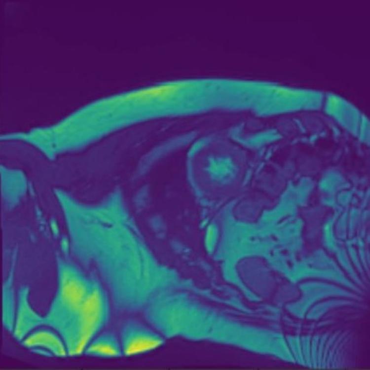
Left Ventricle Segmentation and Volume Estimation on Cardiac MRI Using Deep Learning

Left Ventricle Segmentation and Volume Estimation on Cardiac MRI Using Deep Learning

In the United States, heart disease is the leading cause of death for both men and women, accounting for 610,000 deaths each year. Physicians use Magnetic Resonance Imaging (MRI) scans to take images of the heart in order to non-invasively estimate its structural and functional parameters for cardiovascular diagnosis and disease management. The end-systolic volume (ESV) and end-diastolic volume (EDV) of the left ventricle (LV), and the ejection fraction (EF) are indicators of heart disease.

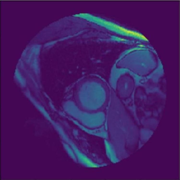
Analytics Pipeline for Left Ventricle Segmentation and Volume Estimation on Cardiac MRI Using Deep Learning

Analytics Pipeline for Left Ventricle Segmentation and Volume Estimation on Cardiac MRI Using Deep Learning

The left ventricle (LV) is the largest chamber in the heart and plays a critical role in cardiac function. Noninvasive cardiac imaging modalities (e.g., cardiac magnetic resonance (CMR), transesophageal echocardiography (TEE), and computed tomography (CT)) are commonly used to study LV size and function in addition to other cardiac structural aspects such as valvular disease, and are invaluable tools for the diagnosis and management of heart disease. However, the process of analyzing cardiac images is time-consuming and labor-intensive.

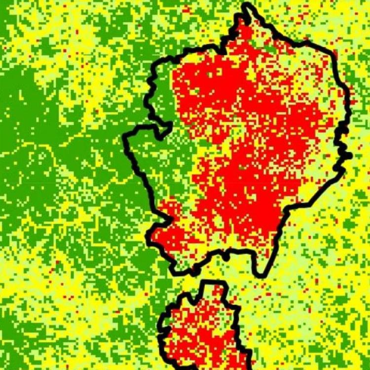
Land Cover Classification at the Wildland Urban Interface Using High-Resolution Satellite Imagery and Deep Learning

Land Cover Classification at the Wildland Urban Interface Using High-Resolution Satellite Imagery and Deep Learning

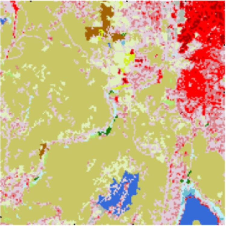
Land cover classification analysis from satellite imagery is important for monitoring change in ecosystems and urban growth over time. However, the land cover classifications that are widely available in the United States are generated at a low spatial and temporal resolution, so that the spatial distribution between vegetation and urban areas in the wildland urban interface is difficult to measure. High spatial and temporal resolution analysis is essential for understanding and managing changing environments in these regions.

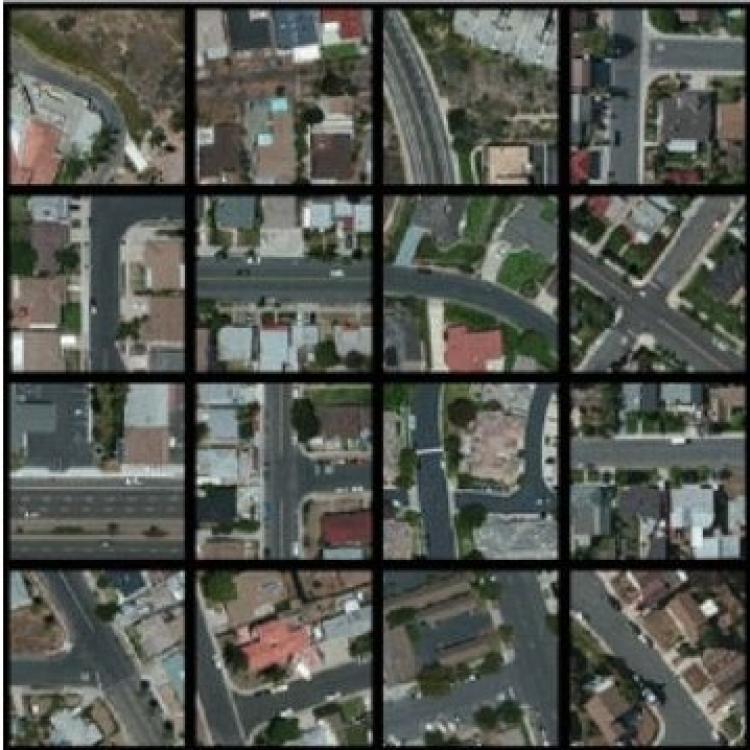
Scalable Detection of Rural Schools in Africa Using Convolutional Neural Networks and Satellite Imagery

Scalable Detection of Rural Schools in Africa Using Convolutional Neural Networks and Satellite Imagery

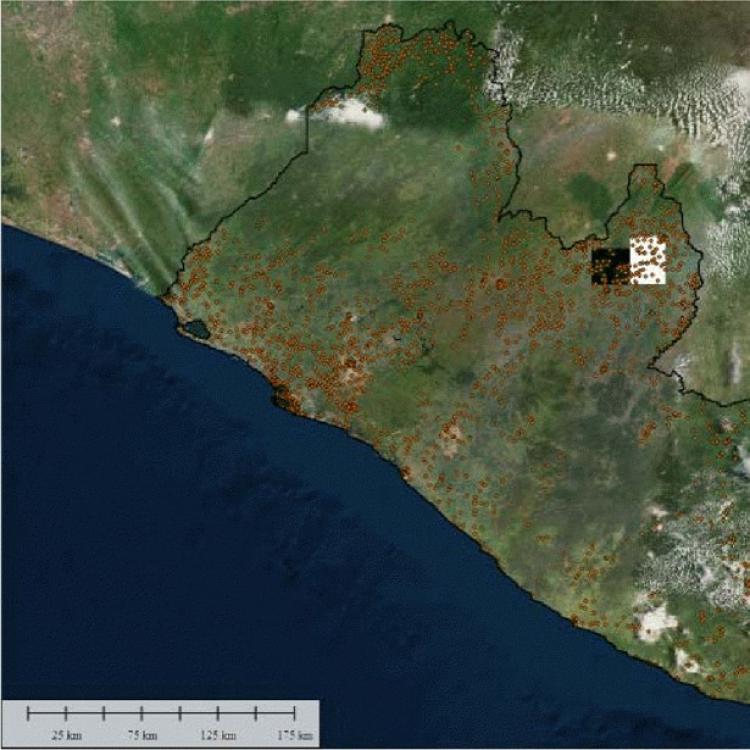
Many countries typically lack sufficient civic data to assess where and what challenges communities face. High resolution satellite images can provide honest assessments of neighborhoods and communities to guide aid workers, policy makers, private sector, and philanthropists. Although humans are very good at detecting patterns, manually inspecting high resolution satellite imagery at scale can be costly and time consuming. Machine learning has the potential to scale this process significantly and automate the detection of regions of interest.

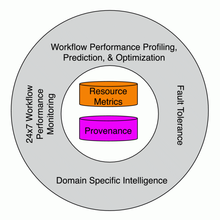
Workflow-Driven Distributed Machine Learning in CHASE-CI: A Cognitive Hardware and Software Ecosystem Community Infrastructure

Workflow-Driven Distributed Machine Learning in CHASE-CI: A Cognitive Hardware and Software Ecosystem Community Infrastructure

The advances in data, computing and networking over the last two decades led to a shift in many application domains that includes machine learning on big data as a part of the scientific process, requiring new capabilities for integrated and distributed hardware and software infrastructure. This paper contributes a workflow-driven approach for dynamic data-driven application development on top of a new kind of networked Cyberinfrastructure called CHASE-CI.

Understanding a Rapidly Expanding Refugee Camp Using Convolutional Neural Networks and Satellite Imagery

Understanding a Rapidly Expanding Refugee Camp Using Convolutional Neural Networks and Satellite Imagery

In summer 2017, close to one million Rohingya, an ethnic minority group in Myanmar, have fled to Bangladesh due to the persecution of Muslims. This large influx of refugees has resided around existing refugee camps. Because of this dramatic expansion, the newly established Kutupalong-Balukhali expansion site lacked basic infrastructure and public service.

Toward a Methodology and Framework for Workflow-Driven Team Science

Toward a Methodology and Framework for Workflow-Driven Team Science

Scientific workflows are powerful tools for the management of scalable experiments, often composed of complex tasks running on distributed resources. Existing cyberinfrastructure provides components that can be utilized within repeatable workflows. However, data and computing advances continuously change the way scientific workflows get developed and executed, pushing the scientific activity to be more data-driven, heterogeneous, and collaborative.

Scaling Deep Learning-Based Analysis of High-Resolution Satellite Imagery with Distributed Processing

Scaling Deep Learning-Based Analysis of High-Resolution Satellite Imagery with Distributed Processing

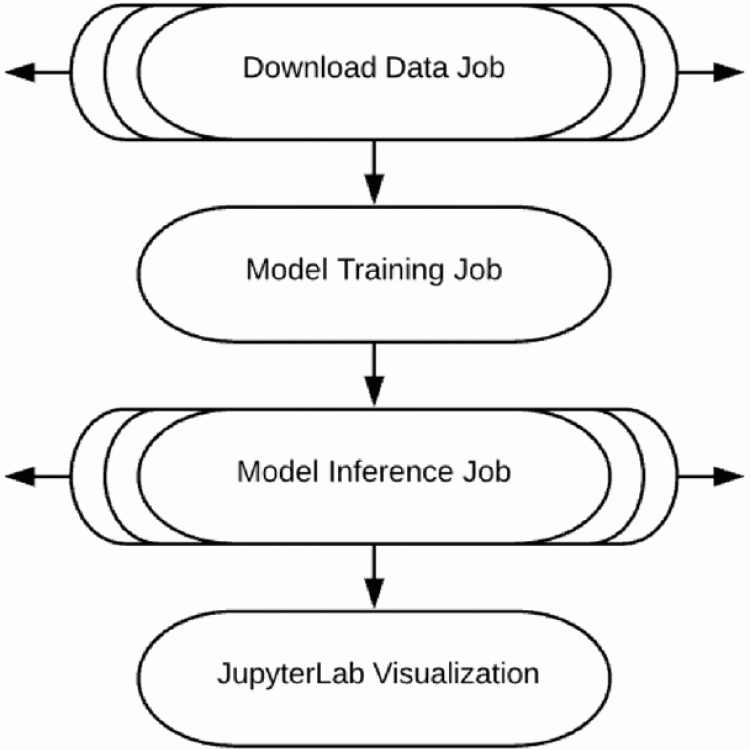
High-resolution satellite imagery is a rich source of data applicable to a variety of domains, ranging from demo-graphics and land use to agriculture and hazard assessment. We have developed an end-to-end analysis pipeline that uses deep learning and unsupervised learning to process high-resolution satellite imagery and have applied it to various applications in previous work. As high-resolution satellite imagery is large-volume data, scalability is important to be able to analyze data from large geographical areas.

The Evolution of Bits and Bottlenecks in a Scientific Workflow Trying to Keep Up with Technology: Accelerating 4D Image Segmentation Applied to NASA Data

The Evolution of Bits and Bottlenecks in a Scientific Workflow Trying to Keep Up with Technology: Accelerating 4D Image Segmentation Applied to NASA Data

In 2016, a team of earth scientists directly engaged a team of computer scientists to identify cyberinfrastructure (CI) approaches that would speed up an earth science workflow. This paper describes the evolution of that workflow as the two teams bridged CI and an image segmentation algorithm to do large scale earth science research. The Pacific Research Platform (PRP) and The Cognitive Hardware and Software Ecosystem Community Infrastructure (CHASE-CI) resources were used to significantly decreased the earth science workflow's wall-clock time from 19.5 days to 53 minutes.

Assessing the Rohingya Displacement Crisis Using Satellite Data and Convolutional Neural Networks

Assessing the Rohingya Displacement Crisis Using Satellite Data and Convolutional Neural Networks

Through the benefits of machine learning, we could quantify an increase in built-up area from 0.4 km in January 2016 to 9.5 km in February 2018 replacing primarily shrub and farmland. We are further able to detect a densification and consequently 'browning' of the refugee camp over time and display its heterogeneous structure. The developed method is scalable, and applicable to rapidly expanding settlements across various regions.

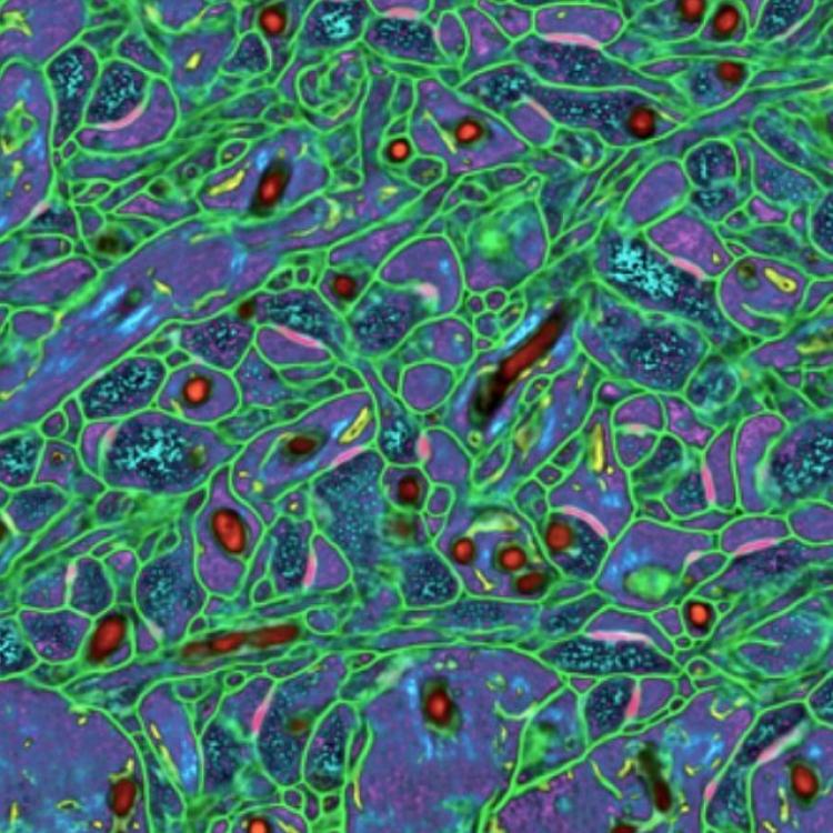
NeuroKube: An Automated and Autoscaling Neuroimaging Reconstruction Framework using Cloud Native Computing and A.I.

NeuroKube: An Automated and Autoscaling Neuroimaging Reconstruction Framework using Cloud Native Computing and A.I.

The neuroscience domain stands out from the field of sciences for its dependence on the study and characterization of complex, intertwining structures. Understanding the complexity of the brain has led to widespread advances in the structure of large-scale computing resources and the design of artificially intelligent analysis systems. However, the scale of problems and data generated continues to grow and outpace the standards and practices of neuroscience.

Towards a Dynamic Composability Approach for Using Heterogeneous Systems in Remote Sensing

Towards a Dynamic Composability Approach for Using Heterogeneous Systems in Remote Sensing

Influenced by the advances in data and computing, the scientific practice increasingly involves machine learning and artificial intelligence driven methods which requires specialized capabilities at the system-, science- and service-level in addition to the conventional large-capacity supercomputing approaches. The latest distributed architectures built around the composability of data-centric applications led to the emergence of a new ecosystem for container coordination and integration.

A Science-Enabled Virtual Reality Demonstration to Increase Social Acceptance of Prescribed Burns

A Science-Enabled Virtual Reality Demonstration to Increase Social Acceptance of Prescribed Burns

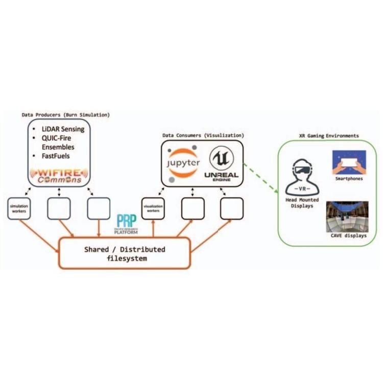
Increasing social acceptance of prescribed burns is an important element of ramping up these controlled burns to the scale required to effectively mitigate destructive wildfires through reduction of excessive fire fuel loads. As part of a Design Challenge, students created concept designs for physical or virtual installations that would increase public understanding and acceptance of prescribed burns as an important tool for ending devastating megafires. The proposals defined how the public would interact with the installation and the learning goals for participants.

Machine Learning for Improved Post-Fire Debris Flow Likelihood Prediction

Machine Learning for Improved Post-Fire Debris Flow Likelihood Prediction

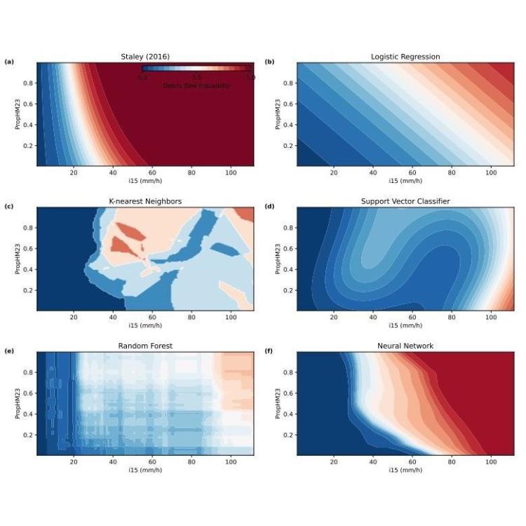
Timely prediction of debris flow probabilities in areas impacted by wildfires is crucial to mitigate public exposure to this hazard during post-fire rainstorms. This paper presents a machine learning approach to amend an existing dataset of post-fire debris flow events with additional features reflecting existing vegetation type and geology, and train traditional and deep learning methods on a randomly selected subset of the data.

FIgLib & SmokeyNet: Dataset and Deep Learning Model for Real-Time Wildland Fire Smoke Detection

FIgLib & SmokeyNet: Dataset and Deep Learning Model for Real-Time Wildland Fire Smoke Detection

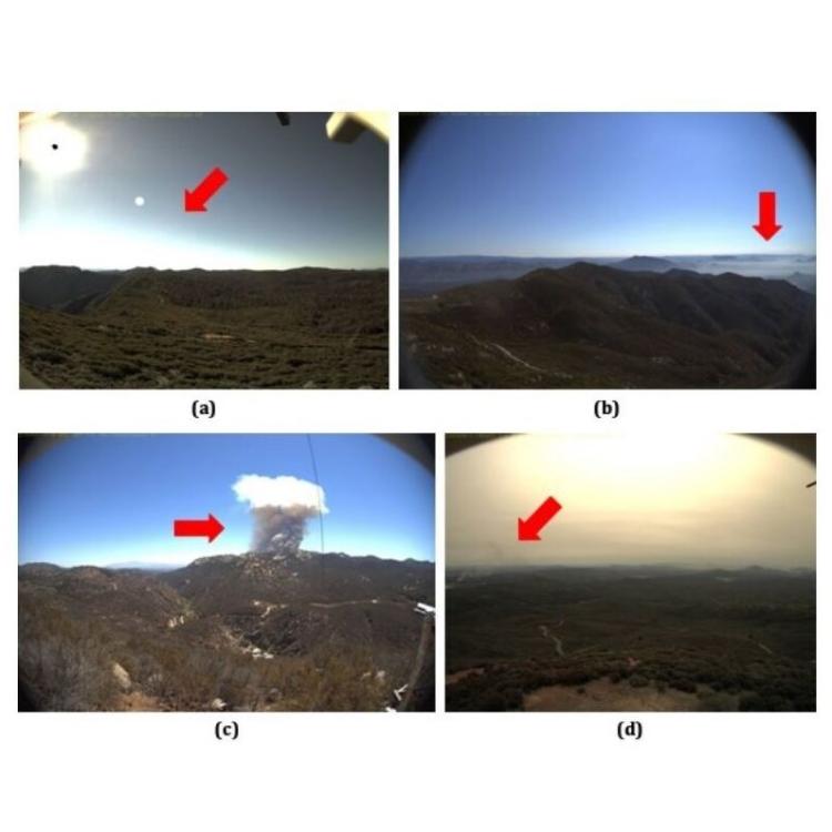
The size and frequency of wildland fires in the western United States have dramatically increased in recent years. On high-fire-risk days, a small fire ignition can rapidly grow and become out of control. Early detection of fire ignitions from initial smoke can assist the response to such fires before they become difficult to manage. Past deep learning approaches for wildfire smoke detection have suffered from small or unreliable datasets that make it difficult to extrapolate performance to real-world scenarios.

NRP

National Research Platform

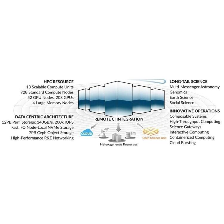
The National Research Platform (NRP), formerly known as the Pacific Research Platform (PRP), is a collaborative, multi-institutional effort to create a shared national infrastructure for data-driven research. Backed by the National Science Foundation (NSF) and the Department of Energy (DOE), the NRP provides high-performance computing resources, data storage and management services, and network connectivity capabilities to researchers across various disciplines (e.g., the earth sciences and health sciences).